 Original Oklahoma Route 23
 Original Oklahoma Route 23

Route Description from 1925 State Highway Map:
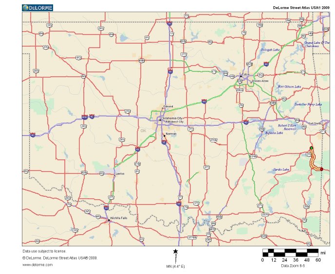
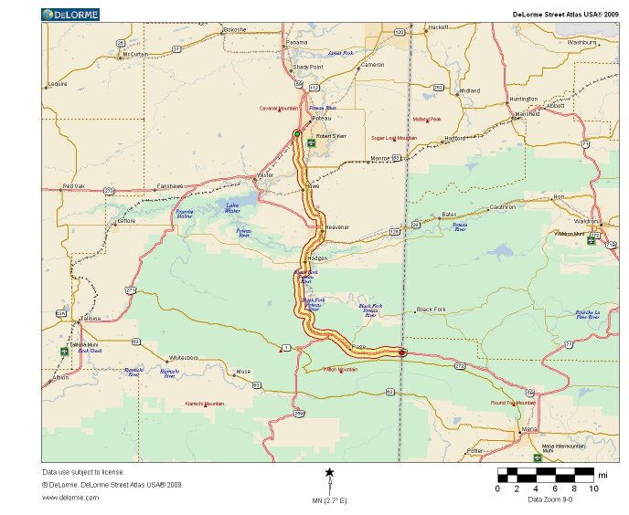
Beginning north of Wister in LeFlore county, at a connection with State Highway No. 3, via Howe, Heavener, to the Arkansas state line toward Mena, AR.
Original Oklahoma Route 23 was a short connector highway linking Poteau with Mena, Arkansas. The following is a rough approximation of the path of Route 23 using modern highways.

A modern version of Route 23 would begin at the junction of US 59 and US 271 at the south end of Poteau and travel south along US 59 toward Howe and Heavener. At Heavener, US 270 would join the road, and the three highways would continue together through Hodgen and Page to the Arkansas state line, where Route 23 would reach its southern terminus.
Though Route 23 was one of the shortest and most inconspicuous of the original state highways, it was nonetheless rendered obsolete by the overlaying of US route numbers just as many of its larger brethren were. The US number on this stretch of road went through many iterations (US 71, US 271, US 371, US 270, and finally US 59) but the designation of any US route on this highway effectively ended the use of the state route number. While it may have been small and short lived, this original route still deserves recognition as one of the first set of numbered Oklahoma highways. Thanks for reading.
Back to 1925 State Routes 13 to 31 Index
Back to Main Page
Base Map Data Copyright DeLorme USA, http://www.delorme.com
State Highway Shields created by Ken Parker of Oklahoma Bridge & Highways Group.