The Distribution Network
 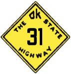 The Distribution Network
The last grouping of highways in the original numbered Oklahoma Highway System filled in the map, branching from the full crossing routes to serve the rest of the state. They ranged in length from almost crossing the state to less than 30 miles between terminii; as with their larger brethren, many portions of these original routes have been overlaid with federal highways over time. However, there are also a few places where these highways have retained their original number since 1925. Several of these routes have been expanded or renumbered since their birth, but still exist as state highways connecting the original communities they were created to serve. These roads represent the beginning of the state highway distribution network we have today; the number of highways may have grown substantially in 8 decades, but what we know today as state highways began with these 18 routes.
 Route 17
 Route 19
 Route 21
 Route 28
Route 31
Back to 1925 State Routes Overview
Back to Main Page
Base Map Data Copyright DeLorme USA, http://www.delorme.com
State Highway Shields created by Ken Parker of Oklahoma Bridge & Highways Group.