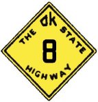
 Original Oklahoma Route 8 Original Oklahoma Route 8
Route Description from 1925 State Highway Map:
From the Kansas state line south of Kiowa, via Cherokee, Carmen, Aline, Cleo, Fairview, Okeene, Hitchcock,
Watonga, Greenfield, Geary, Bridgeport, Binger, Gracemont, Anadarko, Apache, Lawton,
Randlett, to the Red River bridge north of Burkburnett, Texas.
The original Oklahoma Highway 8 was the westernmost of the second tier of highways, providing a north-south trunk line for communities further west of Route 2. We are unsure as to why Route 8 was designated so close to Route 2, but the number clearly identifies Route 8 as a secondary crossing. Like some of the other highways of the second tier, Route 8 has retained its original number to the present day for significant portions of its length. We present below an approximate path for original State Highway 8 using modern highways.

If the full original Oklahoma Route 8 existed today, it would begin, as its modern counterpart still does, at the Kansas state line and travel south toward Cherokee, sharing its roadway briefly with modern SH 11 and US 64 before breaking off alone to travel toward Cleo Springs.

Route 8 joins US 60 south of Cleo Springs, crossing the Cimarron River at Orienta before splitting off near Fairview to join instead with modern SH 58 for a short jog east. Just before reaching the Cimarron again, Route 8 splits off to travel alone again south toward Okeene. After traveling through half of Blaine County alone, SH 8 gains US 270 and US 281 as partners at Watonga.

At Geary, US 270 splits off to the east, while Route 8 and US 281 continue on together, joining old US 66 briefly to cross the Canadian River before turning south toward Hinton. Route 8 and US 281 then continue together toward Binger and Gracemont as they make their way south.

After Gracemont, Route 8 and US 281 reach Anadarko, where the original route's concurrence with modern SH 8 comes to an end. If the original Route 8 still existed, it would continue with US 62 and US 281 as they traveled together first west, then south toward Apache. At the south end of Lake Ellsworth, US 277 joins the road and the four highways continue toward Lawton, merging with Interstate 44 for the final few miles before reaching town.

At Lawton, US 62 leaves to head west, while Route 8 follows the US 281 business loop through Lawton before rejoining the mainline as the highways join I-44 for a few miles before splitting from the interstate again. Route 8 would follow US 277 and US 281 as they travel south past Randlett before joining I-44 for the last time for the run to the southern terminus of Route 8 at the Red River.
Route 8 is one of the rare state highways that has managed to retain its original designation for a substantial portion of its path to the present day, despite being overlaid with US highways for much of that distance. While the number has been removed for the southern third of the original path, abolishing the full crossing status of the highway, Route 8 is still worthy of notice for the amount of original numbering remaining. Thanks for reading.
Back to 1925 State Routes 7 to 12 Index
Back to Main Page
Base Map Data Copyright DeLorme USA, http://www.delorme.com
State Highway Shields created by Ken Parker of Oklahoma Bridge & Highways Group.