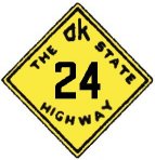
 Original Oklahoma Route 24 Original Oklahoma Route 24
Route Description from 1925 State Highway Map:
Beginning at Frederick in Tillman County, via Tipton, Altus, Blair, Mangum, Willow, Sayre, and Cheyenne, to the Texas state line at a point near Durham.
Oklahoma Route 24 as designated in the 1925 highway system was a fairly lengthy north-south route that "filled in the web" to stitch together several communities in far southwest Oklahoma and provide links between the more major highways in the region. As will become evident, this corridor became more important over time than its original number would perhaps suggest. The following is an approximation of the path of Route 24 using modern highways.

If original Route 24 existed today, it would begin in Frederick and travel west out of town concurrent with modern SH 5; after following with SH 5 through Tipton, Route 24 would join instead with US 283 north of Elmer and head north toward Altus. As the highways cross original Route 7 at Altus, modern SH 6 joins US 283 and Route 24 and the triplexed highways travel together through Blair before SH 6 leaves again bound for Granite. Route 24 and US 283 travel west to Mangum, where SH 34 joins the road. As the three highways continue north, SH 9, still following the general path of original Route 9, joins and leaves the concurrence.

A modern version of Route 24 would continue with US 283 and SH 34 as they travel north through Willow, with Route 24 following US 283 when SH 34 splits off north of town. As the highways pass through Sayre, they share a brief concurrence with original Route 3, which became US 66 in this area. Continuing north from town, Route 24 would again share the road with US 283 alone as they make their way to Cheyenne.

At Cheyenne, Route 24 and US 283 are joined by SH 47, and shortly thereafter by SH 33. The four highways wind their way north to Roll, where SH 47 splits off to the east just before Route 24 would finally leave US 283 behind; a theoretical Route 24 would follow SH 33 west to the Texas border, where it would reach its northern terminus.
The general corridor first served by Route 24 quickly became quite important to interstate commerce, as is obvious by the designation of US 283, which usurped most of the highway's original service path. Route 24 survived the major renumbering of Oklahoma's highways in 1930, but when US 283 was designated in 1932, Route 24 immediately ceased to exist; the portions of the route that were not appropriated by the federal route were renumbered as portions of other state routes, erasing Route 24 from the map in one fell swoop. This highway, like many of its peers, illustrates the foresight of the early highway commission; even this tertiary route, with its high number, became largely a federal highway due to its eventual importance to trade. We hope you enjoyed this look at an early southwest connector.
Back to 1925 State Routes 13 to 31 Index
Back to Main Page
Base Map Data Copyright DeLorme USA, http://www.delorme.com
State Highway Shields created by Ken Parker of Oklahoma Bridge & Highways Group.